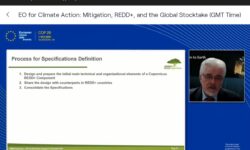
The REDDCopernicus Consortium organised a series of online workshops with five different tropical regions in September-November 2020 to collect User feedback on the proposed forest monitoring products/ services. This feedback from REDD+ countries is a key input to consolidate the design of a future Copernicus Service on REDD+ and Forest Monitoring (FM). Initially planned as physical meetings, the workshops were successfully held as online webinars with interactive hands-on sessions using dedicated online tools such as a Web-Geoportal and expert surveys.
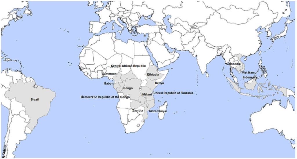
- Seven regional workshops were organised with 35 institutions from South-East Asia, East Africa, Central Africa, South America (Brazil), as well as Southern African Development Community (SADC) region
- About 100 participants attended these workshops with national actors active in forest monitoring and management (Ministries, National Forest Inventory or Climatic/ Environmental services in charge of REDD+ reporting) as well as several regional institutions
- Workshops consisted of a dynamic combination of live presentations and demonstrations of different prototype products to improve forest monitoring and reporting in the context of REDD+ MRV as well as other environmental monitoring programmes
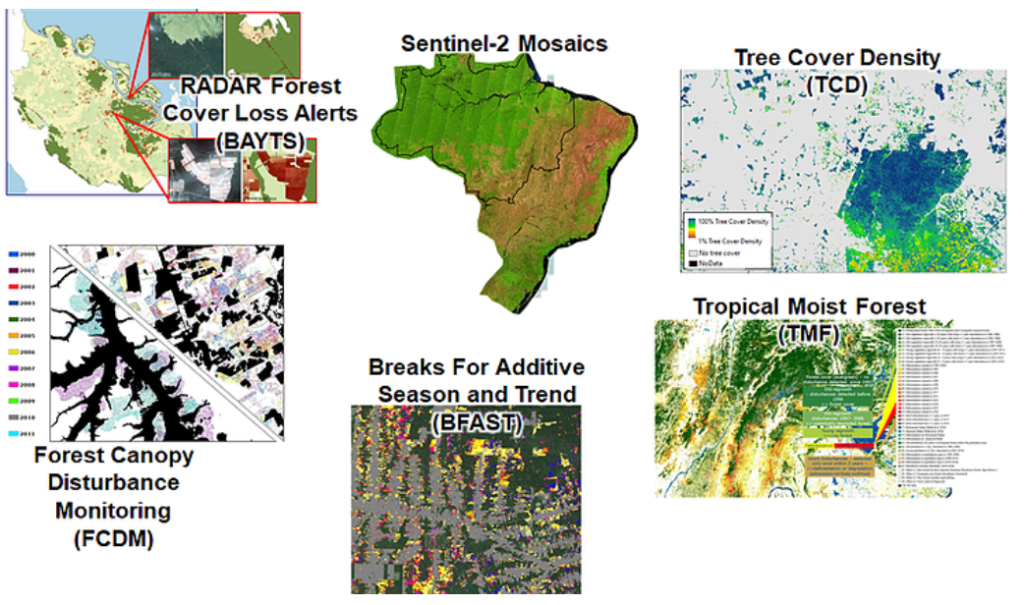
- Presented prototype products were divided into four data and one service solution concepts:
- Analysis Ready Satellite Data
- Forest/ Tree Cover Status Maps
- Forest Cover Change Maps
- Forest Disturbance and Alerting Maps
- Platform and Service Solutions for Data Processing, Download and Analysis
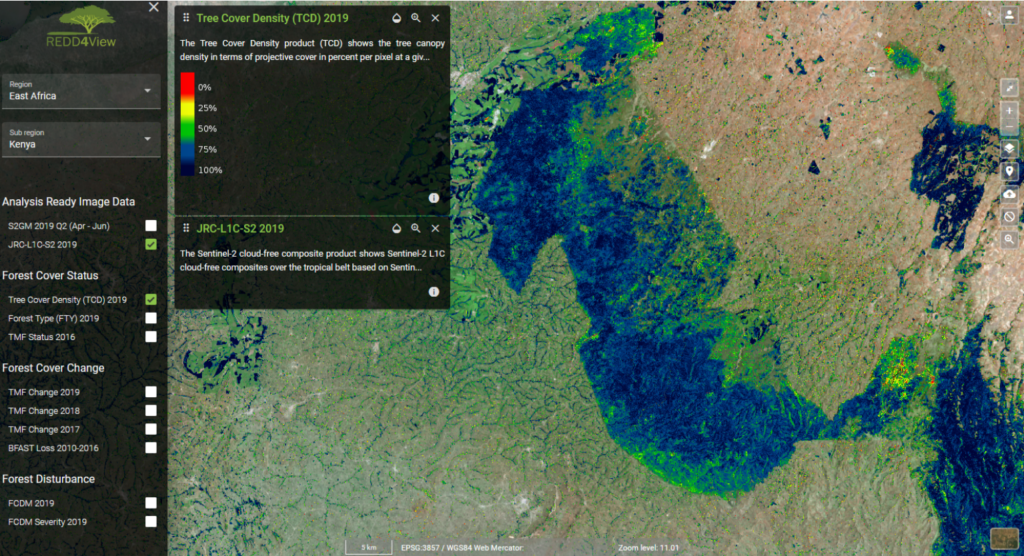
- Case studies were presented for ten test sites across the tropics through the REDD4View Geoportal – specifically developed for the webinars to enable the participants to interactively assess the presented concepts
- At the end of each session the Users’ feedback was collected via online questionnaires and this feedback will at a later step be used to consolidate the initial design
- All presentations can be accessed here: https://www.reddcopernicus.info/downloads
The seven workshops held across different tropical regions were a great success thanks to an active participation of the Users and their expert feedback on the presented concepts. A wealth of information was collected for each of the five concepts through the online expert questionnaires, and a preliminary summary is given here:
- Analysis Ready Satellite Data: Single-date Sentinel-2 (S2) imagery mainly preferred as reference, S2 composites are endorsed as input for land cover classifications
- orest/ Tree Cover Status Maps: Important to map long-time history of evergreen forest types with Users also being able to apply own (national) forest definitions
- Forest Cover Change Maps: Concept considered very relevant but applicability has to ensure to cover both humid and dry forest ecosystems
- Forest Disturbance and Alerting Maps: User endorsement of the applicability over different forest ecosystems, of the fine spatial detail of the disturbance detections and of the near real-time (NRT) monitoring component
- Platform and Service Solutions: While the Users generally endorsed a combination of web- and desktop-based solutions, the majority preferred web-based platforms, which furthermore allow the Users to customize the provided data products
Further relevant feedback also came from the lively discussions and webinar chats that accompanied the presentations and the interactive hands-on sessions of the learning exercises.
That positive User feedback is a cornerstone in the consolidation process of designing a future Copernicus Service on REDD+ and FM, and this will take place in the coming the months.