The REDDCopernicus Project Evaluates Capacities and Requirements for a Future REDD+ and Forest Monitoring Service Component within the European Copernicus Land Monitoring Service.
Project Aim
To prepare a framework for Copernicus REDD+ and Forest Monitoring Services. Additionally, the Project reviews the potential for EO applications for Sustainable Forest Management in Europe. All activities are undertaken in consultation with stakeholders.
Two key factors are to:
Co-ordinate and consolidate the European Capacity for EO based Forest Monitoring (EO FM) with relevant stakeholders, International Agencies, Research Community and Private Sector.
Identify research gaps in forest monitoring
Project Structure
Assessment of Requirements and Capacities
Stakeholder Requirements and Policy Review
Consultation and Review of Existing Capacities in Forest Monitoring
Initial Design of Copernicus REDD+ and Forest Monitoring Service Component
This is a proposed multilateral service to support sustainable pan-tropical forest monitoring based on EO data from the Copernicus Sentinel satellites. The Service concept is drafted bottom-up by the Consortium in consultation with REDD+ countries, the European Commission and other stakeholders.
THE PROCESS
This is a proposed multi-lateral service developed bottom up in consultation with REDD+ countries, the EC and other stakeholders. The project seeks to understand what is required for an operational pan-tropical REDD+ service. Participant consultant nations (signatories to the Paris Agreement) provide their expertise and local understanding in conjunction with the European Partners to define the needs of the countries and both their common and individual requirements in relation to monitoring and maintaining their forests.
At the end of the process, a REDD+ service component will be proposed to be embedded in the existing Copernicus Global Land Service.
FOREST MONITORING PRODUCTS
A suite of potential products were presented within the Initial Design Document. A dedicated geoportal was developed to showcase these products for different regions. Credentials to access the REDD4View geoportal can be provided on request.
WHY?
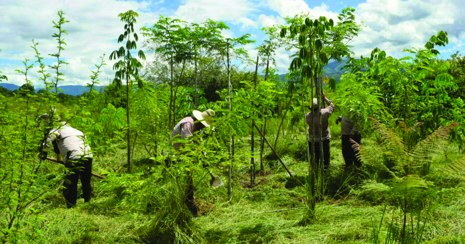
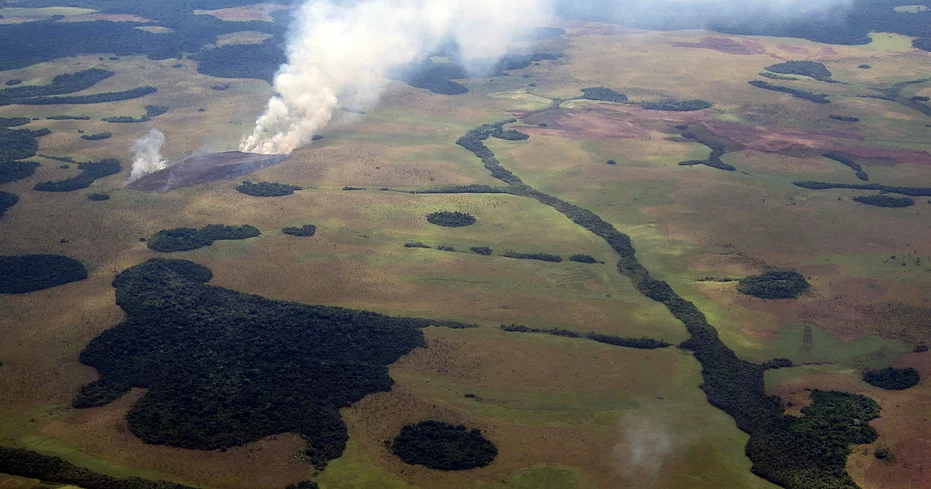
The application of Earth Observation (EO) for forest monitoring can support decision making in reversing deforestation/degradation.
The European Sentinel data provides an opportunity for the development of a pan-tropical EO forest service with related downstream applications. The access to this service will be beneficial for global partners.
Copernicus Programme
Copernicus is the European Union’s Earth Observation Programme with its fleet of Sentinel satellites. The programme provides both, services and cutting edge Earth Observation (EO) instruments and tools. Sentinel Satellites provide global EO data with high resolution, frequent acquisitions and long-term mission continuity, ideally suited for Forest Monitoring Systems at all scales. The data is suitable to assist Sustainable Forest Management (SFM) globally.
European Sentinel Satellites
EO data from the European Sentinel Satellites has capacity to support forest monitoring in the Equatorial and Sub-tropical zones in Africa, Asia and Latin America. The Sentinel satellites operate in the spectral and radar wavelength. Combining data from different sensors and missions can give a more complete picture of forests located in geographically inaccessible locations. Having more comprehensive forest information means countries can better implement national policies and international Conventions to reduce deforestation and degradation.
We use cookies to optimise our website and service.
Functional
Always active
The technical storage or access is strictly necessary for the legitimate purpose of enabling the use of a specific service explicitly requested by the subscriber or user, or for the sole purpose of carrying out the transmission of a communication over an electronic communications network.
Preferences
The technical storage or access is necessary for the legitimate purpose of storing preferences that are not requested by the subscriber or user.
Statistics
The technical storage or access that is used exclusively for statistical purposes.The technical storage or access that is used exclusively for anonymous statistical purposes. Without a subpoena, voluntary compliance on the part of your Internet Service Provider, or additional records from a third party, information stored or retrieved for this purpose alone cannot usually be used to identify you.
Marketing
The technical storage or access is required to create user profiles to send advertising, or to track the user on a website or across several websites for similar marketing purposes.